


Courtesy- National Weather Service
INDIANAPOLIS — UPDATE: The NWS has canceled the tornado watch for Bartholomew County as of 3 p.m. Also, Bartholomew, Jackson, and Jennings Counties are under a Flood Advisory until 8:15 p.m.
ORIGINAL:
The National Weather Service (NWS) has issued a Tornado Watch for most of Central Indiana including Bartholomew, Johnson, Jackson, Jennings counties until 5 p.m. this afternoon. A Wind Advisory is also in effect until 8 p.m.
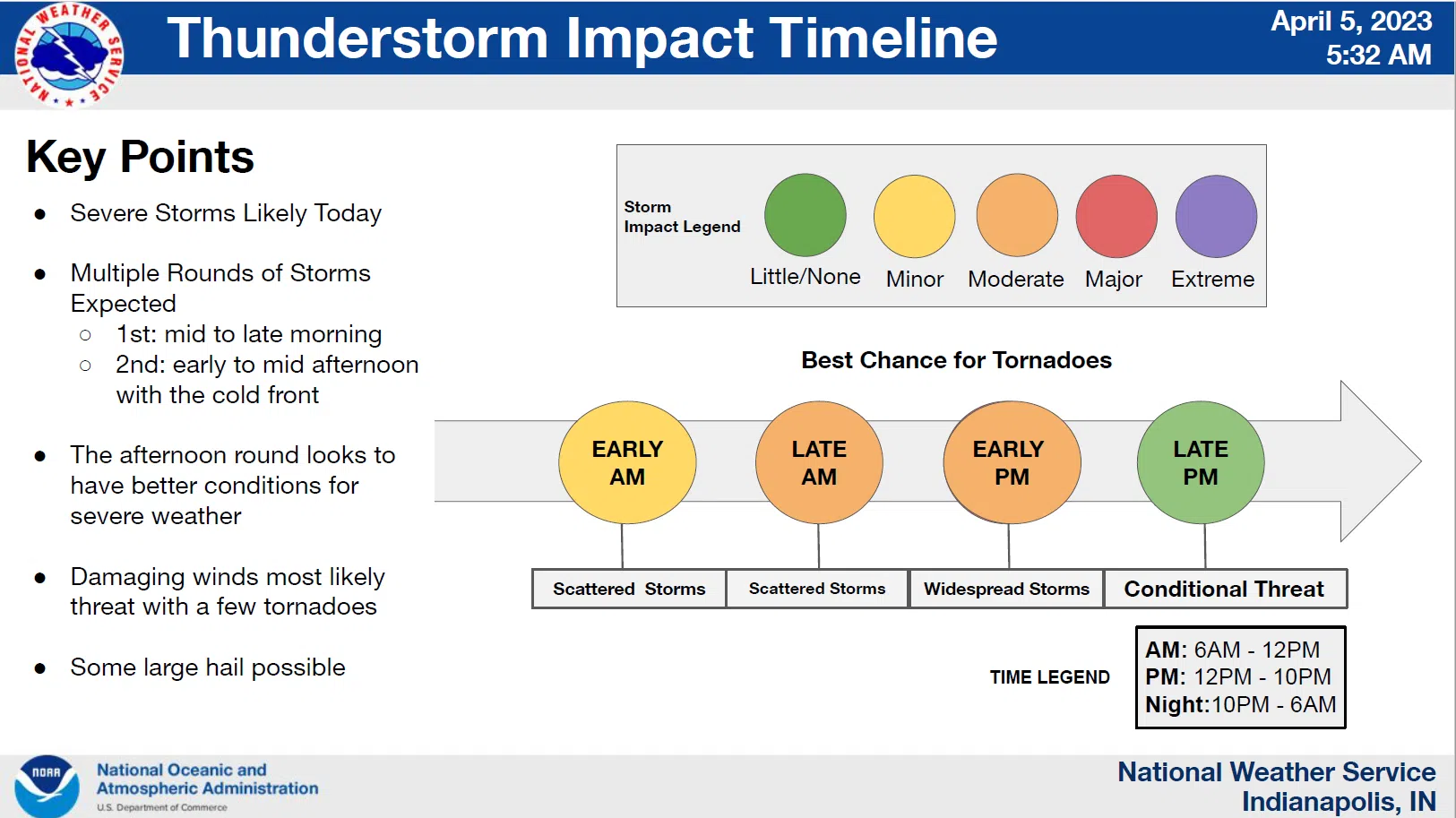
In addition, most of the state is under an Enhanced Risk for severe weather. The storms are expected to come in multiple rounds with the first round in the mid to late morning, and the second coming in the afternoon when the cold front moves through, per Bartholomew County Emergency Management (BCEM). Damaging wind, tornadoes, large hail are all possible with the damaging wind and tornadoes most likely. 20-25 mph wind gusts are expected this morning, 45 mph gusts are expected in the afternoon, and winds of 35 mph are expected tonight.
Courtesy – NWS.