


SOUTHCENTRAL, Ind. –A Severe Thunderstorm Warning remains in effect for much of south-central Indiana, including Bartholomew, Jackson, Jennings, and Johnson County.
This storm system has produced 60+ mph winds and penny-sized hail that has left approximately 12,000 people in the Indianapolis area without power. The National Weather Service additionally reminds that those regions are still under a Tornado Watch, with potential for isolated tornadoes during this storm system. The storm is expected to impact Bartholomew County at around 5:15 p.m. and Jackson and Jennings at around 5:30 p.m.
For minute-to-minute live weather updates, tune into QMIX 107.3, KORN Country 100.3, or MOJO 102.9 here
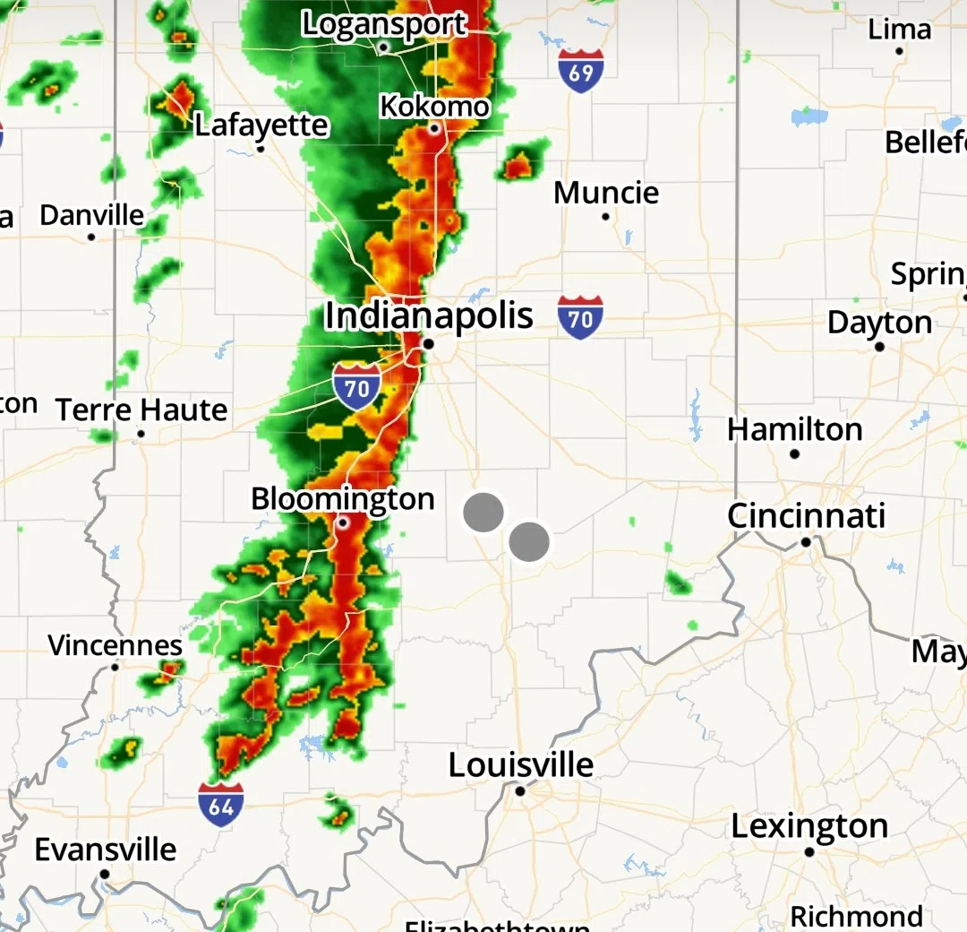
The National Weather Service in Indianapolis has issued a Severe Thunderstorm Warning for southern Monroe County, southern Brown County, southwestern Bartholomew County, Lawrence County, and Jackson County until 5:30 p.m.
At 4:43 p.m., severe thunderstorms were located along a line extending from eight miles south of Bloomington to Paoli, moving northeast at 40 mph. High wind gusts up to 60 mph and penny-sized hail are possible. Damage to roofs, siding, and trees is expected.
The affected area includes Interstate 65 near mile marker 48 and between mile markers 52 and 66.
For your protection, move to an interior room on the lowest floor of a building.