SOUTH-CENTRAL, Ind. - The National Weather Service (NWS) in Indianapolis has issued a Flood Watch for Bartholomew, Jackson, Jennings, Brown, and Decatur Counties in south-central Indiana through Saturday afternoon.
Flooding, due to excessive rainfall, is possible for portions of central, south-central, southeast, southwest, and west-central Indiana.
Excessive runoff might cause flooding of rivers, creeks, streams, and other low-lying, flood-prone locations.
Multiple rounds of thunderstorms producing heavy rainfall will impact southern portions of central Indiana through early Saturday, with 1 to 3 inches of rainfall predicted. Visit NWS at http://www.weather.gov/safety/flood for more information about Flood Watches and Flood Warnings.
Residents should monitor later forecasts and be alert for possible Flood Warnings. Those living in areas prone to flooding should be prepared to take action should flooding develop.
JACKSON COUNTY, Ind. - The Indiana State Police (ISP) -Versailles Post responded to an accident on northbound I-65, near the 44-mile marker between Crothersville and Seymour, on Friday morning, June 26.
EDINBURGH, Ind. - The annual Edinburgh Firecracker Festival will celebrate the 250th anniversary of the United States of America on Saturday, July 4, in downtown Edinburgh.
COLUMBUS, Ind. (UPDATE: 6/25) - Columbus Police Department (CPD) detectives continue to investigate the death of a 39-year-old Seymour man that occurred at Mill Race Park on Wednesday, June 24.
HOPE, Ind. – The Town of Hope has announced that the "Old Fashioned Independence Day" event has been greatly scaled down due to the forecasted rain and threat of severe thunderstorms on Friday, June 26.
SOUTH-CENTRAL, Ind. - The National Weather Service (NWS) in Indianapolis says that south-central Indiana will see an increasing chance for showers and thunderstorms this weekend. The biggest concern is from late Thursday night into Friday, when widespread, heavier rainfall may lead to flooding.


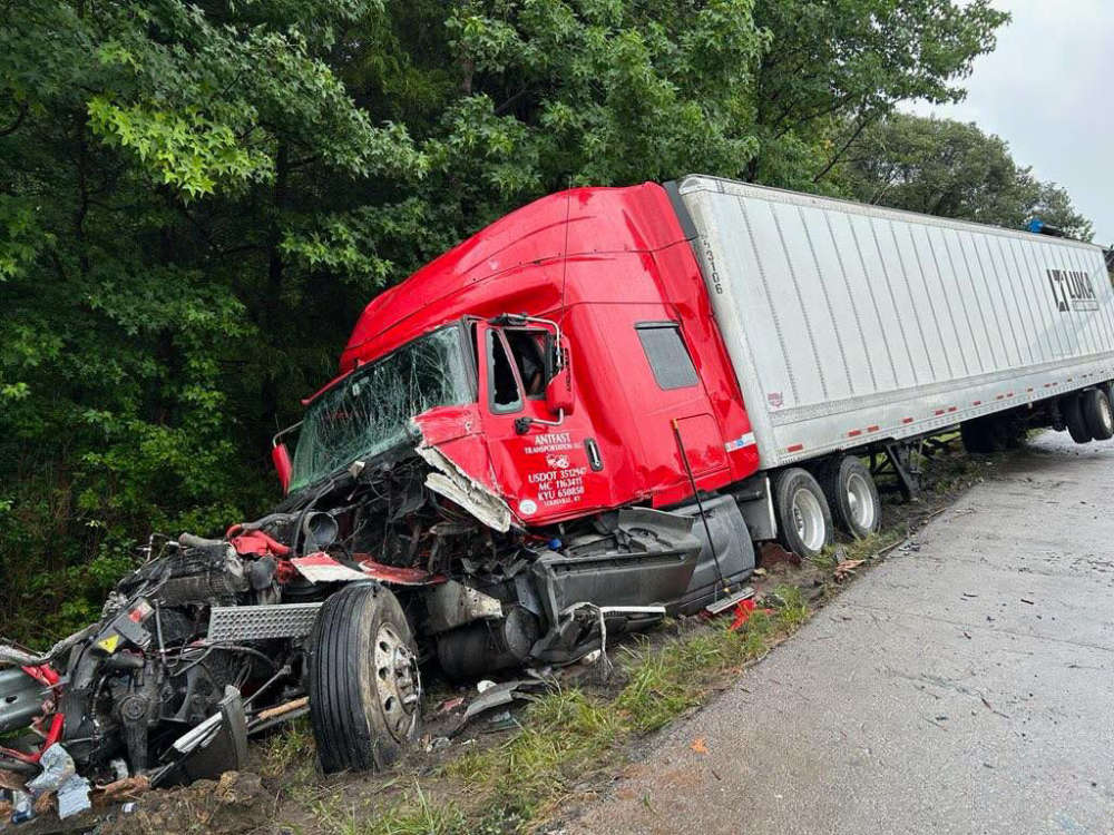 Semi-truck crash on I-65 causes injuries, interstate closure
 Edinburgh Firecracker Festival honors America's 250th birthday
 More details released about Mill Race Park death
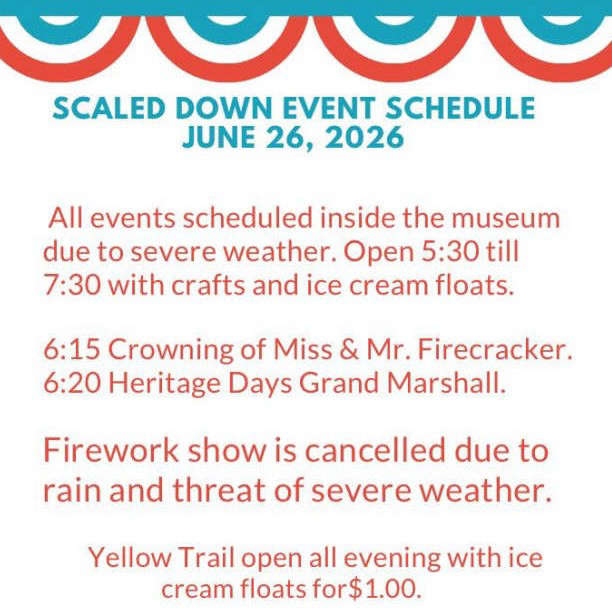 Hope's 'Old Fashioned Independence Day' is partially canceled due to weather
 Heavy rain is possible this weekend; heat returns next week